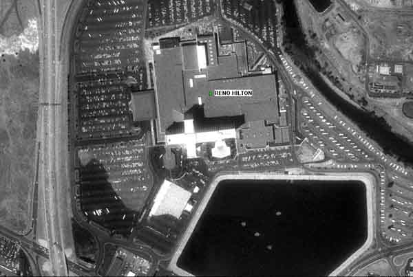
JPG Image 1 meter resolution using USA Photo Maps
|
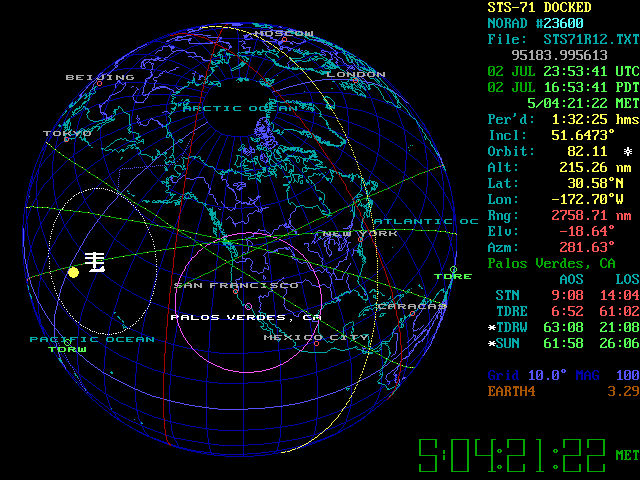
STS Plus screen shot
|

STS Plus screen shot
|
|
NAVIGATION SOFTWARE
1) USA Photo Maps by JDM Cox (Sample image file saved as a jpg image is to the left obtained from
program)
This program is great and we use it daily. With a laptop and GPS you can pre download aerial imagery
of areas and see where you are or driving via aerial imagery. It tracks you as
you drive similar to navigation software except you have images instead of maps. It also combines TOPO maps with our suggestion to John. Great program here. Excellent for Search
And Rescue, real estate or other occupations. We have all of California and Nevada "Pre Downloaded" from 1 meter
resolution to 64 meter resolution. The only limitation is how much hard drive
space you have.
- To download Full Install version 2.14 click here
- To download update file click here
- JDMCOX website
SATELLITE TRACKING SOFTWARE
1) David Ransom's STS Orbit Plus. (Sample screen
shots to left)
This is a great program to track weather satellites, GPS
satellites or any satellites of concern.
- STS Program
- Earth File
- STS website
- FTP For Satellite Telemetry
|